Plan routes.
Navigate precisely.
The professional tool for route planning, real-time navigation and operational documentation.
Trusted by or connects with
 Royal Netherlands Marine Corps
 Royal Netherlands Army
Everything in one app
Built for teams that work in the field
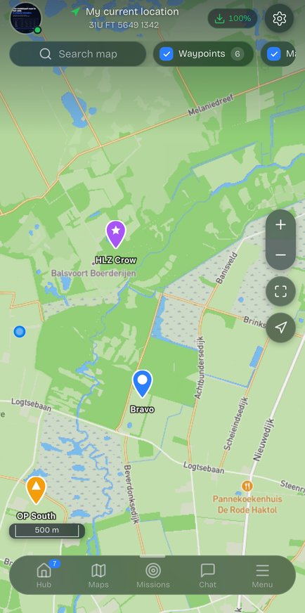
Maps & routes
Plan routes with waypoints, MGRS coordinates and automatic distance and time calculation on any basemap.
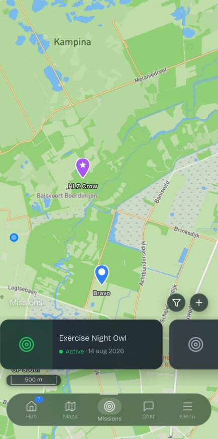
Missions
Run your whole operation: briefing, O-group, phasing and live participants in a single mission overview.
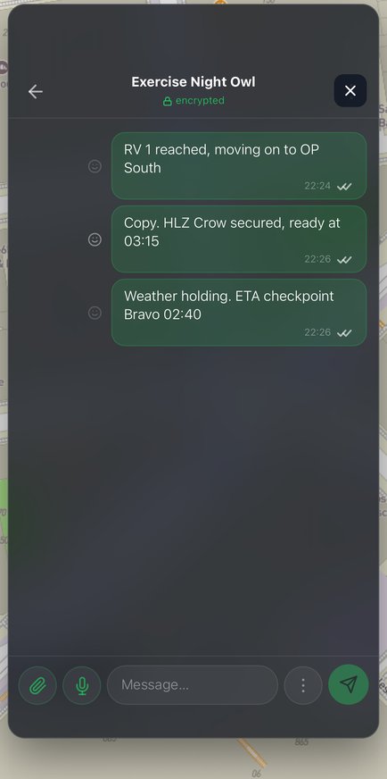
Encrypted chat
End-to-end encrypted team comms with location sharing, tied directly to your map and mission.
3D Flyover
Fly your route in 3D over the terrain to scout elevation, cover and lines of sight in advance.
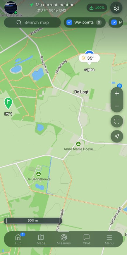
Weather on site
Live weather, wind, visibility and sunrise/sunset right on your area of operations — available offline.
Avalanche terrain & slope angle
Terrain analysis
Steepness, slope angle and avalanche terrain as a map overlay for a safe route choice.
Take MilMap with you
into the field.
Maps, missions, tasks and encrypted comms — on your phone, online and offline. Available now on the App Store and Google Play.
Maps
It all starts with the map
From digital route map to 3D recon — prepare every leg down to the detail.
340 m — WP CHARLIE
Koers 047° · rechtsaf bij splitsing
Missions
Run your mission, from A to Z
Give structure to every operation — from format to briefing to execution in the field.
SMEAC · Missieformat
Operatie Nachtvos
Chat
Communicate securely in the field
Everything your team needs to stay connected, encrypted and ready for the field.
Team Bravo
Positie bereikt, CP Charlie
Kap. de Vries
Roger, hou vast
Eenheid Alpha
O-group om 0700
Sgt. Jan Kaas
Spraakbericht
Waypoint Import
Import from
your favorite app.
Already created a route in Garmin, Google Maps or TopoGPS? Import it straight into Milmap. Waypoints are automatically converted to MGRS coordinates and are immediately editable.
Export your route
Save your route as GPX, KML or KMZ from your navigation app.
Import into Milmap
Drag the file into Milmap or upload via the import button.
Ready to use
Waypoints are converted to MGRS and immediately editable.
Supported platforms & formats
Strava
GPX / TCX
Komoot
GPX
TopoGPS
GPX
AllTrails
GPX
Garmin Connect
GPX / FIT
Google Earth
KML / KMZ
More formats on request. TCX, FIT, GPX 1.1, GeoJSON and CSV are supported.
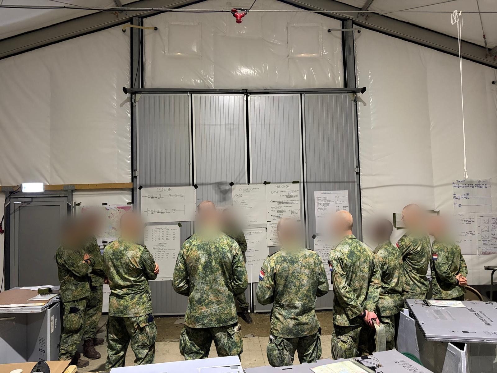
Bergtraining
Korps Mariniers
Noorwegen
Tijdens de bergtraining van het Korps Mariniers in Noorwegen werd MilMap ingezet voor het aanmaken van professionele routekaarten in Senja (Noorwegen)
Toepassing
Routekaarten & operationele planning
Omgeving
Bergterrein boven de sneeuwgrens
Eenheid
Korps Mariniers, Koninklijke Marine
Output
PDF routekaart met MGRS-coördinaten
Korps Mariniers
Koninklijke Marine Nederland · Bergtraining
Ingezette functionaliteit
- Routekaarten aangemaakt met MGRS-coördinaten
- PDF routekaart geprint voor veldinzet
- Terreinanalyse bergpassen en kampen
- Offline kaarten voor gebruik zonder verbinding
- Missions-module voor O-group planning
Ingezet in alpine omstandigheden — offline kaarten en PDF routekaarten als operationeel back-up bij beperkte verbinding.
Pricing
Simple. Transparent.
Start free. Upgrade when you're ready.
Starter
Forever free — no credit card needed
- Save 5 maps
- Route planning (basic routes)
- Display MGRS coordinates
- Online map layers
- Import GPX
- MilMap mobile app
Pro
Or €34,99/year — save 27%
- Unlimited map storage
- Mission planning (SMEAC/O-group)
- Export PDF route maps
- Marked areas
- Offline maps (unlimited)
- MGRS coordinates
- Elevation profile & terrain analysis
- Weather integration
- GPX/KML import & export
- Priority support
Team
For min. 10 users — that's €19.99/month
- Everything in Pro
- Up to 10 team members included
- Shared team maps
- Real-time synchronisation
- Bulk PDF export per team
- Team admin panel
- Shared waypoint management
- Priority support (SLA)
- Onboarding session
+€1,99/monthly per extra user from user 11
All prices incl. VAT · Cancel anytime
FAQ
Frequently asked
questions.
Question not listed? Send us a message and we'll respond within one business day.
Contact
We'd love
to hear from you.
Questions about the product, request a demo or interested in the Team plan? Send us a message via our contact form.
support@milmap.nl
Response time
Within a few days
Location
Nederland